Maulden Hydrological Mapping
Background #
During January and February 2024, Maulden experienced a series of unprecedented flooding incidents across various parts of the village. Maulden itself is situated on the relatively higher ground of the Greensand Ridge, and the nearest river, The River Flit, is located approximately 25 metres below the village elevation at a distance of around 2 kilometres.
The primary cause of the flooding was runoff from the surrounding hills, triggered by a period of violent and persistent precipitation. This intense rainfall resulted in a number of significant incidents both within and around the village. Later that year, Maulden Parish Council (MPC) issued a 2024 Flood Report .
Following this report, I decided it would be valuable to produce a Topographic Wetness Index (TWI) map for the entire parish. My mapping corroborated the incidents reported by the MPC. My original TWI mapping was completed in August 2024. See my TWI notes for details regarding the implications of TWI.
Early this spring (2026), while working on a mapping project related to the Maulden bridleway incident, I met a lady who is a local campaigner opposed to new housing developments in the village. Like many local authorities nationwide today, councils are pursuing what can only be described as a “land grab,” pushing aggressively to build new housing in as many locations as possible.
I introduced her to my TWI mapping for the village, and she has since been using it as a reference resource in her efforts to halt local developments. She had previously shown a particular interest in using potential flooding risks as a fundamental reason to oppose further rural expansion. The lady shared my work with a colleague of hers, a trustee of a nationwide countryside charity, who immediately took an interest. Very quickly, the charity recruited me into their Bedfordshire Planning Team.
I am currently working with the charity on several mapping projects in neighbouring villages, providing hydrological evidence to argue against further development. In the last five months alone, I have completed mapping for four other local villages, and there are more planned. I cannot reproduce these results here as doing so might compromise the charity’s ongoing work.
Maulden Hydrological Maps #
The mapping work undertaken for Maulden is detailed below. I must note that this work has unfortunately caused friction among a small number of individuals in the village, leading to some “local politics” over the issue last summer. However, when this kind of resistance arises, it is a strong indication that the subject matter is truly important.
One would logically expect such detailed mapping to benefit local planners and the community by helping them prepare for potential flood incidents. Unfortunately, this is not the case here; I suspect this is due entirely to powerful vested interests. After all, land that is potentially vulnerable to surface water flooding might not be easily sold to local authorities.
Given the local reaction, I was initially reluctant to release my mapping of the village. However, I have changed my mind and decided to publish it for public consumption.
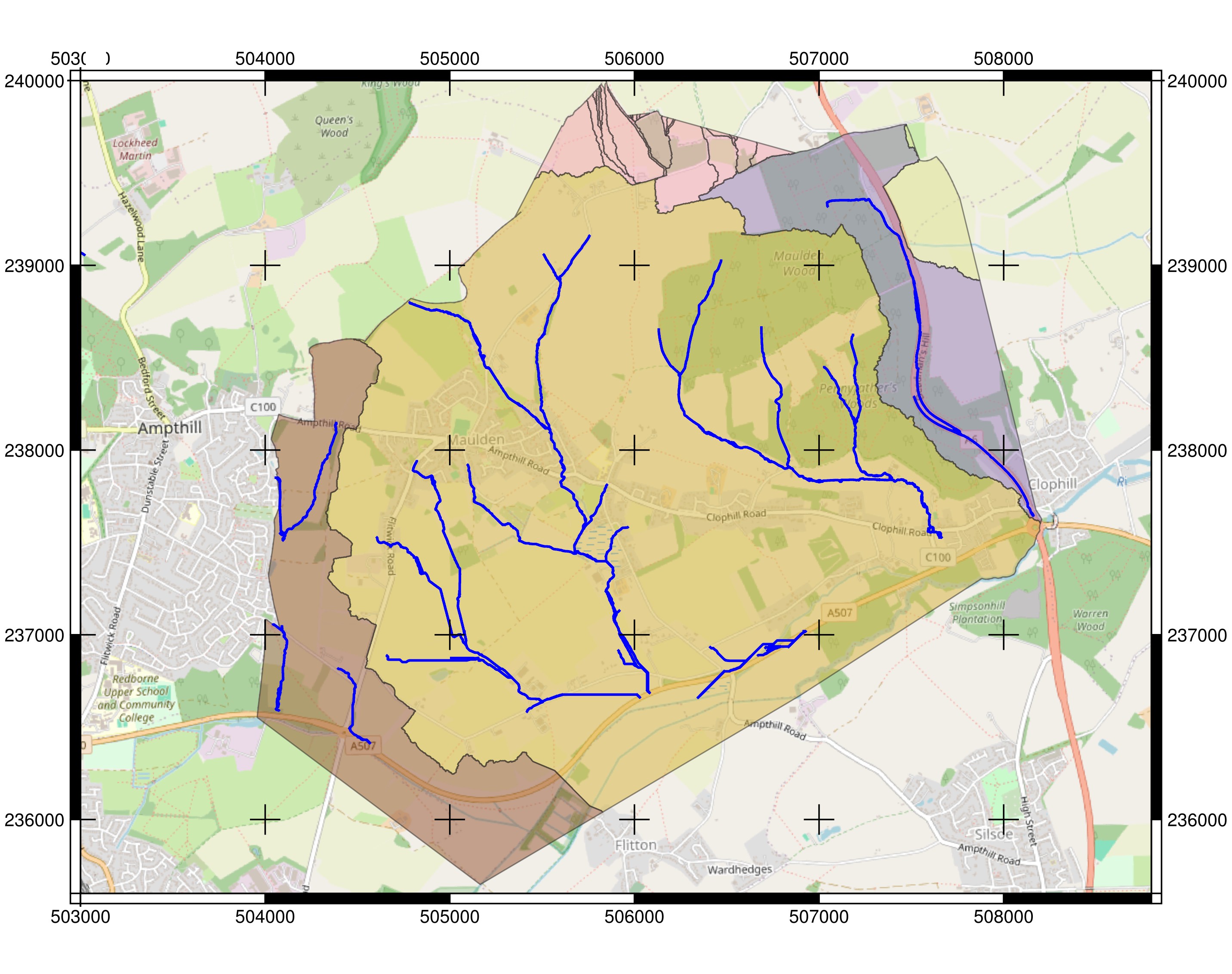
Figure 1: Maulden watershed basins and principle flow channel network (blue lines). Enlarged version.
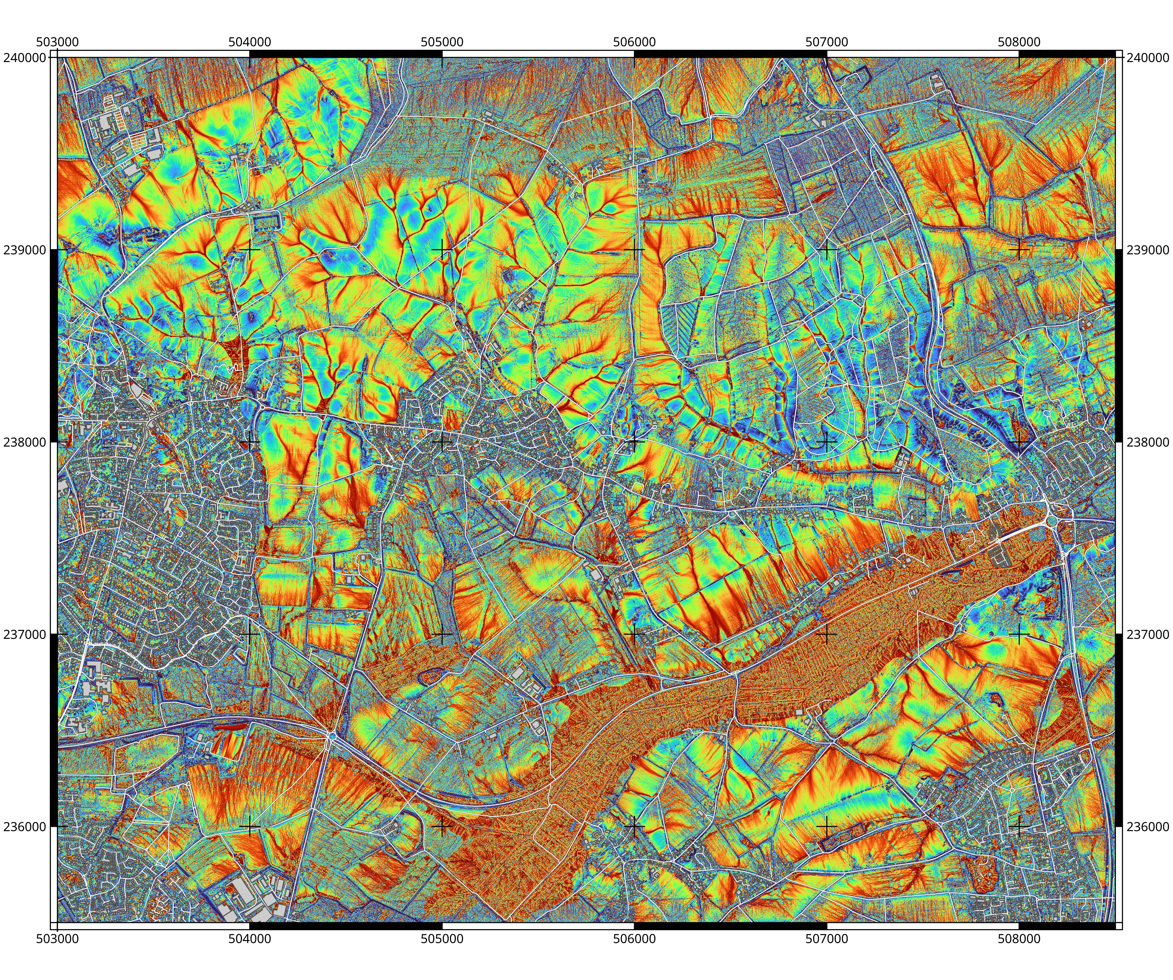
Figure 2: Maulden Topographic Wetness Index (TWI). The red TWI areas show locations that have propensity for high surface water accumulation. Enlarged version.
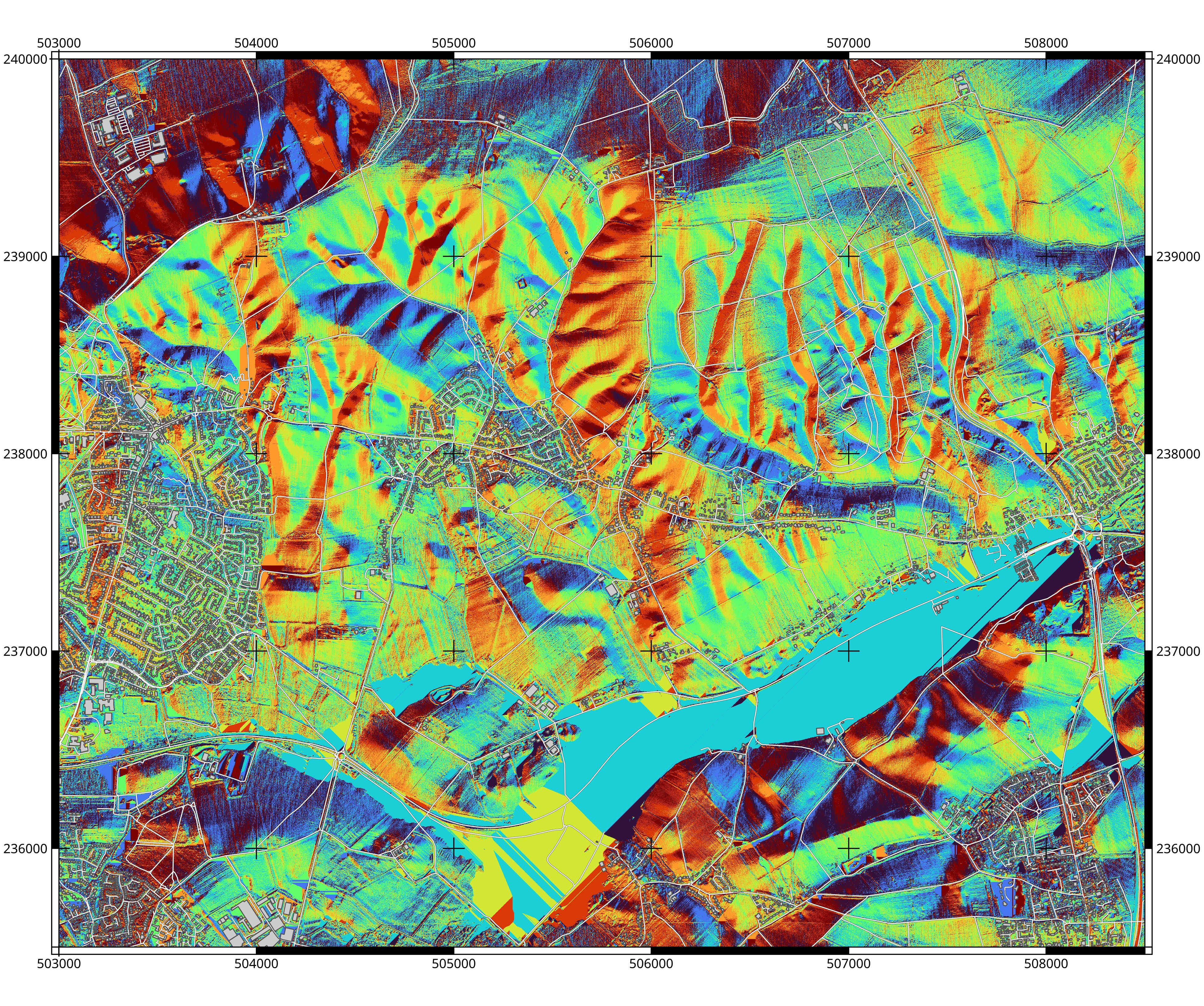
Figure 3: Maulden geographical surface water sheet flow direction. Enlarged version.
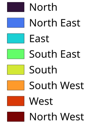
Figure 4: Water flow direction legend.
Page updated: Saturday, November 21, 2026.