Air Ambulance Laser Attack
Background and methodology #
On the 27th of December 2023, at 2:30 a.m., an East Anglian Air Ambulance helicopter was targeted in Attleborough, Norfolk. The attack involved someone using a handheld laser device from the ground, aiming to impair the pilot’s vision. A video of the incident was released at the time by various national and local news sources.
Clearly, actionable intelligence in this case would be to determine the geographical location of the laser in terms of an Ordnance Survey grid reference for it on the ground. It is possible to take an oblique air photo such as the one below and transform it into geographical coordinates. I was able to obtain a still image from the original video footage, which clearly showed the green laser light towards the mid-right side. See Figure 1.
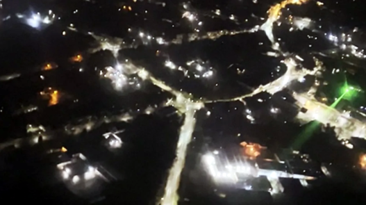
Figure 1: Original air photo taken over Attleborough town centre, showing the green laser centre right.
The raw air photo needed to be georeferenced so that an estimate of the laser location could be determined. The georeferencing process relies on identifying known ground control points in the original image, and matching them to their respective geographical coordinates.
This process was fairly tricky in this particular case. It was a night scene and the image quality was less than ideal. I managed, after some fairly careful examination of the image to find suitable control points. After identifying as many useful ground control points as possible between the raw aerial photograph and the base map of Attleborough town centre, I successfully georeferenced the image shown in Figure 2.
Just to make it clear what has happened: The georeferencing process has flattened, rotated, and reprojected into geographical coordinates the original raw air image.
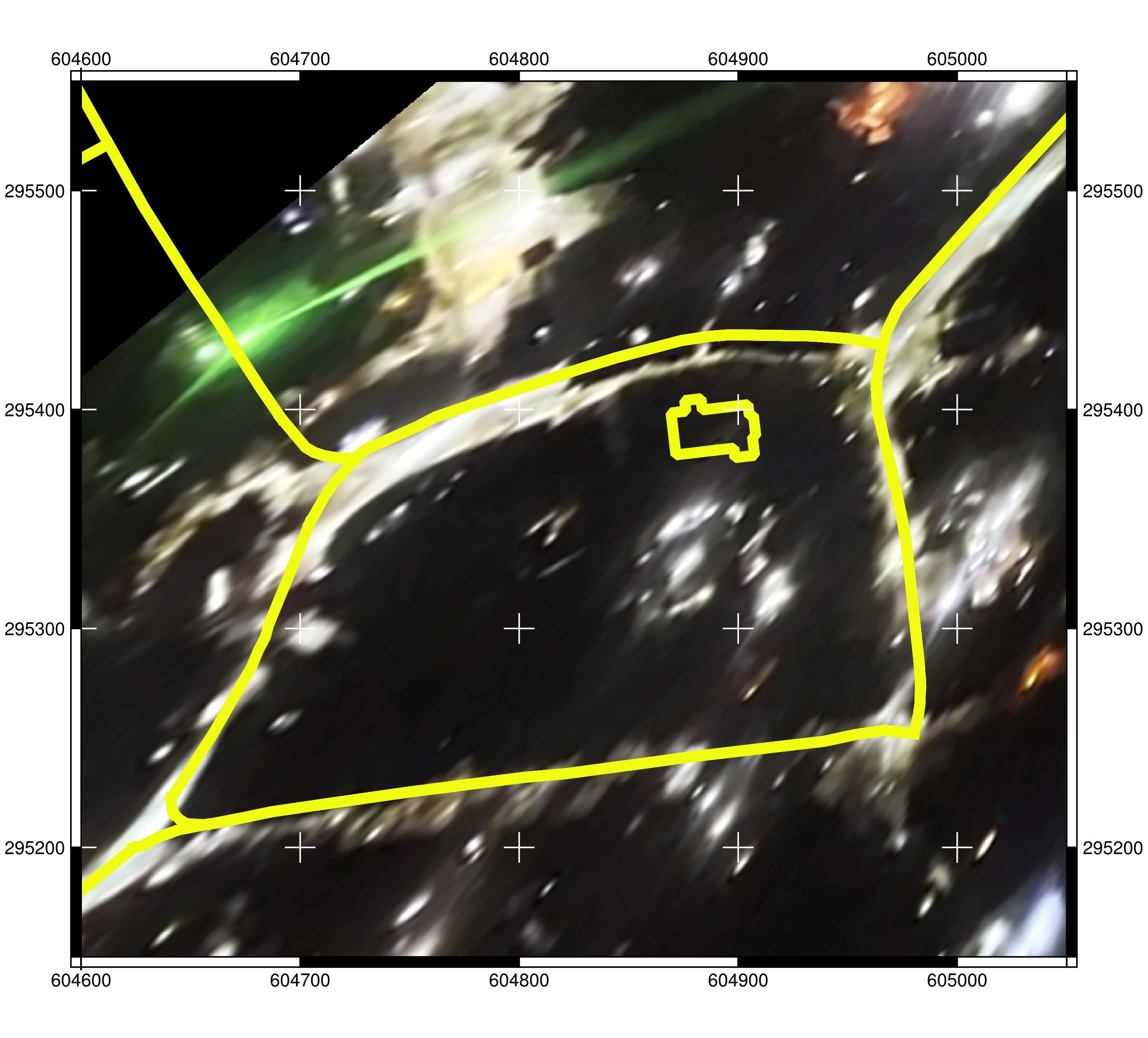
Figure 2: Georeferenced oblique air photo. The laser position is just intersecting the yellow road lines to the top left of the image
The thick yellow lines on the map are the road centres, sourced from Open Street Map. I plotted the road centres on the map, just to give myself some confidence of the accuracy of the georeferenced results. While this is not the sharpest georeference of an oblique air photograph I have ever completed, it was accurate enough to provide a reliable estimate of the geographical position of the laser.
Using the marked laser position on the georeferenced image, I was then able to plot the location onto the base map of Attleborough town centre, as shown in Figure 3, along with the Ordnance Survey grid coordinates for it.
The approximate location of the laser was found to be close to the Lidl entrance in the supermarket car park on Queens Road.
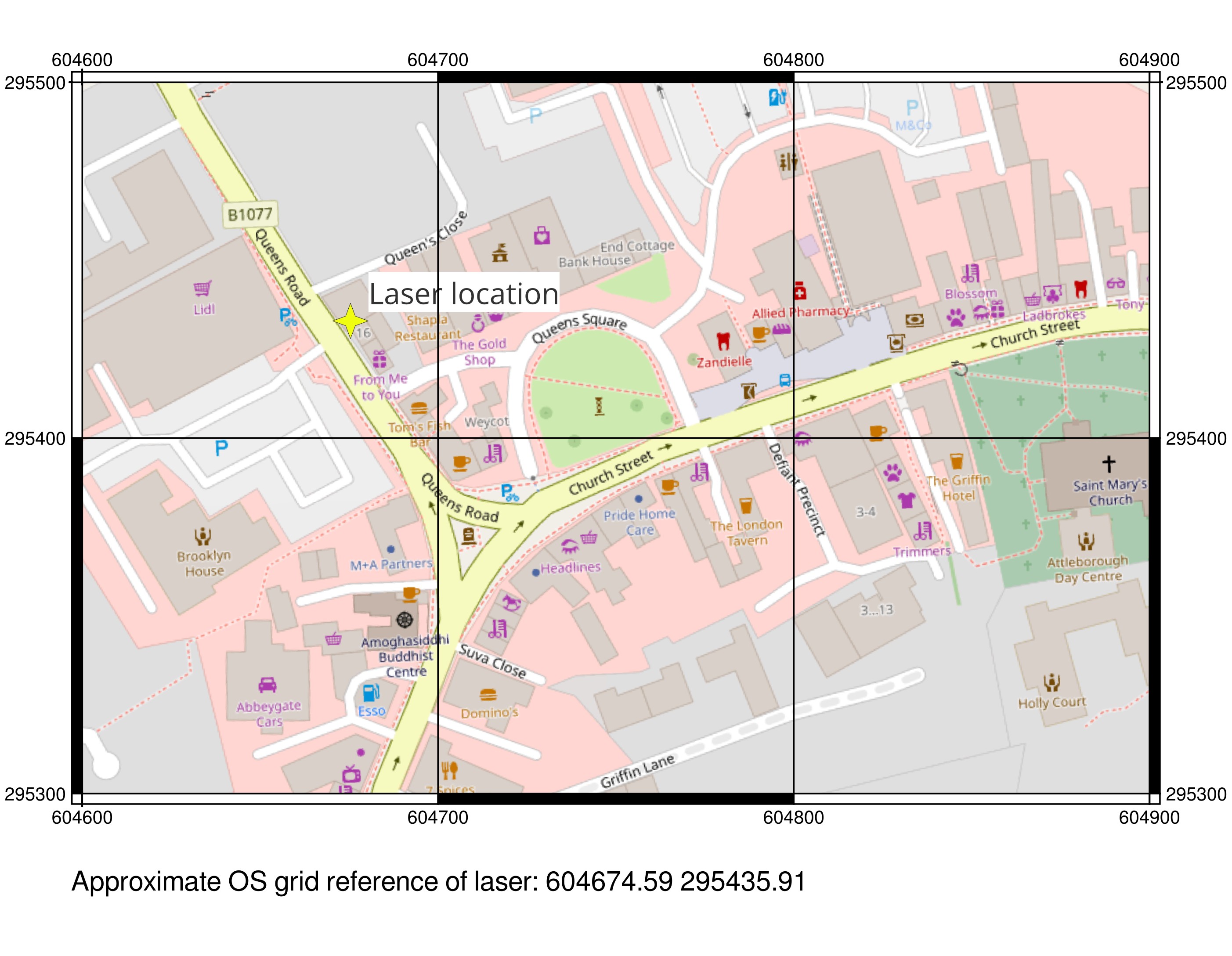
Figure 3: Attleborough town centre map showing estimated position of the laser.
Conclusion #
This information was forwarded to both the East Anglian Air Ambulance and Norfolk Police in the hope that it might assist in tracking those responsible for the attack.
East Anglian Air Ambulance were enthusiastic concerning my results. They suggested that I should contact the police directly. I did as they asked, but unfortunately I never had any response from them.
The whole incident now has faded into the past, and I don’t know if anybody was ever held accountable for their actions.
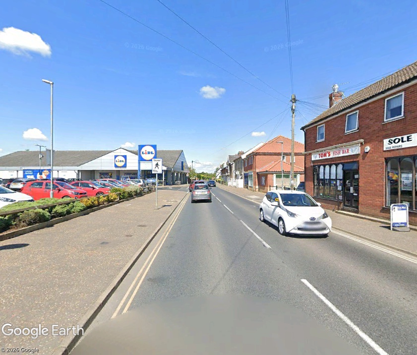
Figure 4: Queens Road, showing the approximate position of where the laser was directed from.
Page updated: Tuesday, November 17, 2026.